


Voting District 100002, Washington County, New York
About
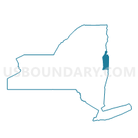
Outline

Summary
| Unique Area Identifier | 638171 |
| Name | Voting District 100002 |
| County | Washington County |
| State | New York |
| Area (square miles) | 24.08 |
| Land Area (square miles) | 24.01 |
| Water Area (square miles) | 0.07 |
| % of Land Area | 99.72 |
| % of Water Area | 0.28 |
| Latitude of the Internal Point | 43.32906880 |
| Longtitude of the Internal Point | -73.40494930 |
Maps


Graphs
Select a template below for downloading or customizing gragh for Voting District 100002, Washington County, New York


Neighbors
Neighoring Voting District (by Name) Neighboring Voting District on the Map
- Voting District 010001 010003, Washington County, NY
- Voting District 070003-070005, Washington County, NY
- Voting District 100001, Washington County, NY
- Voting District 110001, Washington County, NY
- Voting District 130001, Washington County, NY
- Voting District 130002, Washington County, NY
Top 10 Neighboring County Subdivision (by Population) Neighboring County Subdivision on the Map
- Kingsbury town, Washington County, NY (12,671)
- Granville town, Washington County, NY (6,669)
- Argyle town, Washington County, NY (3,782)
- Hartford town, Washington County, NY (2,269)
- Hebron town, Washington County, NY (1,853)
Top 10 Neighboring Unified School District (by Population) Neighboring Unified School District on the Map
- Hudson Falls Central School District, NY (15,389)
- Argyle Central School District, NY (3,996)
- Hartford Central School District, NY (3,027)
Top 10 Neighboring State Legislative District Lower Chamber (by Population) Neighboring State Legislative District Lower Chamber on the Map
Top 10 Neighboring State Legislative District Upper Chamber (by Population) Neighboring State Legislative District Upper Chamber on the Map
Top 10 Neighboring 111th Congressional District (by Population) Neighboring 111th Congressional District on the Map
Top 10 Neighboring Census Tract (by Population) Neighboring Census Tract on the Map
- Census Tract 840, Washington County, NY (6,669)
- Census Tract 803, Washington County, NY (5,390)
- Census Tract 870, Washington County, NY (3,782)
- Census Tract 850, Washington County, NY (2,269)
- Census Tract 860, Washington County, NY (1,853)
Top 10 Neighboring 5-Digit ZIP Code Tabulation Area (by Population) Neighboring 5-Digit ZIP Code Tabulation Area on the Map
- 12828, NY (9,448)
- 12832, NY (7,106)
- 12827, NY (3,877)
- 12865, NY (3,663)
- 12809, NY (3,528)
- 12838, NY (608)